The Bird’s-Eye View: Aerial Photography of La Paz, Mexico
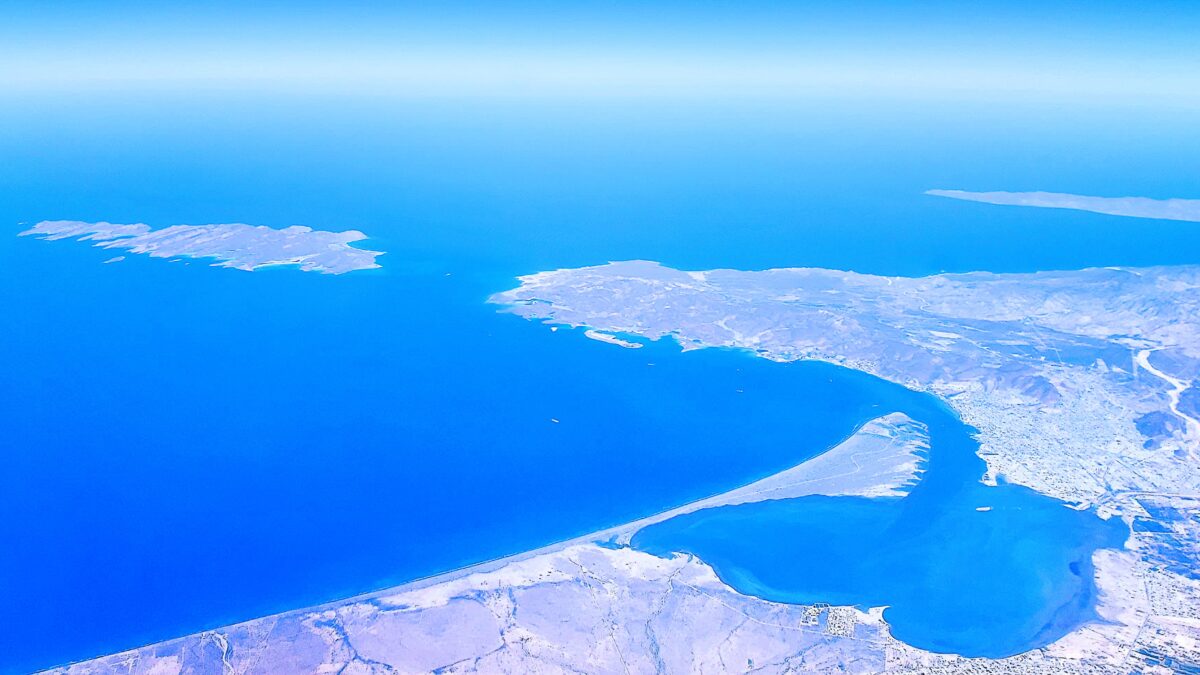
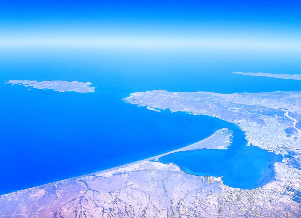
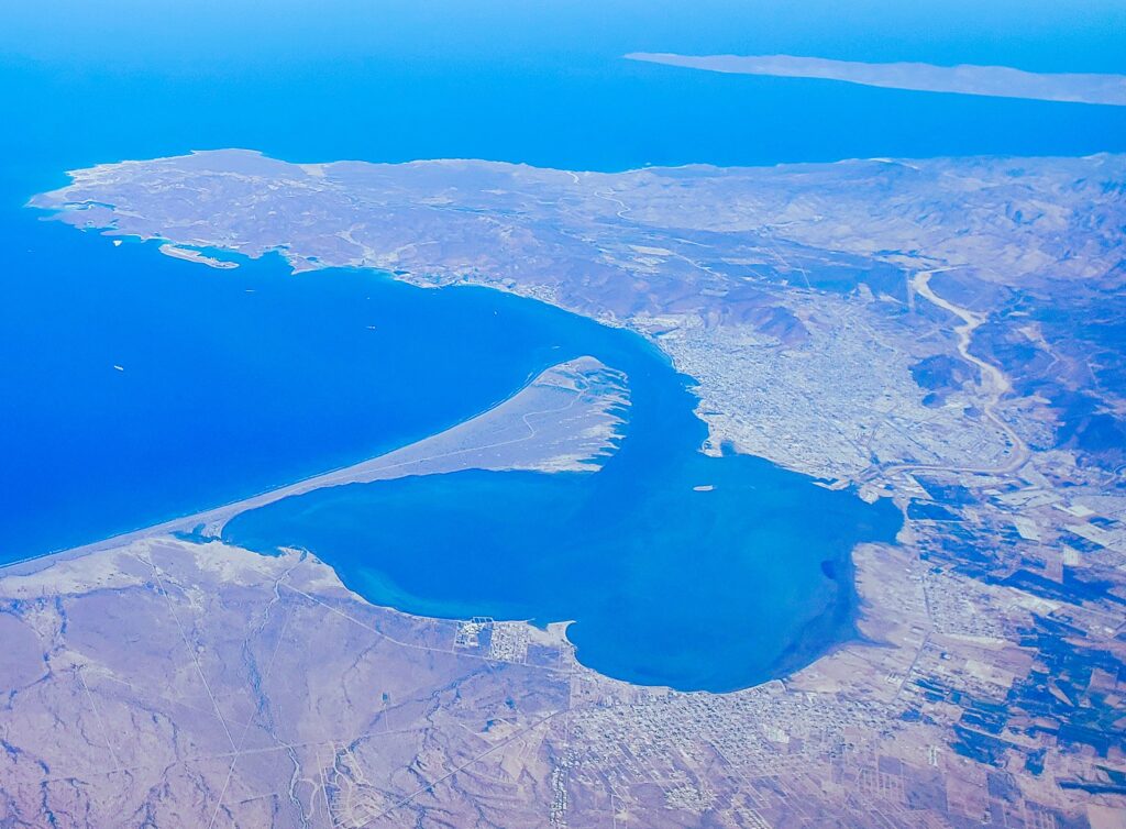
Capturing an aerial view of La Paz, Mexico offers a perspective that ground-level shots simply can’t match. As you fly over the southern tip of the Baja Peninsula, the stark contrast between the arid desert mountains and the deep, crystalline blues of the Sea of Cortez becomes the main event. This coastal capital in Baja California Sur is defined by its sprawling bay, the iconic Malecón boardwalk, and some of the most pristine white-sand coastlines in North America. These aerial photos of La Paz highlight the unique geography of a city tucked between the rugged Sierra de la Giganta range and a marine sanctuary teeming with life.
Flying Over Espiritu Santo Island & Balandra Bay
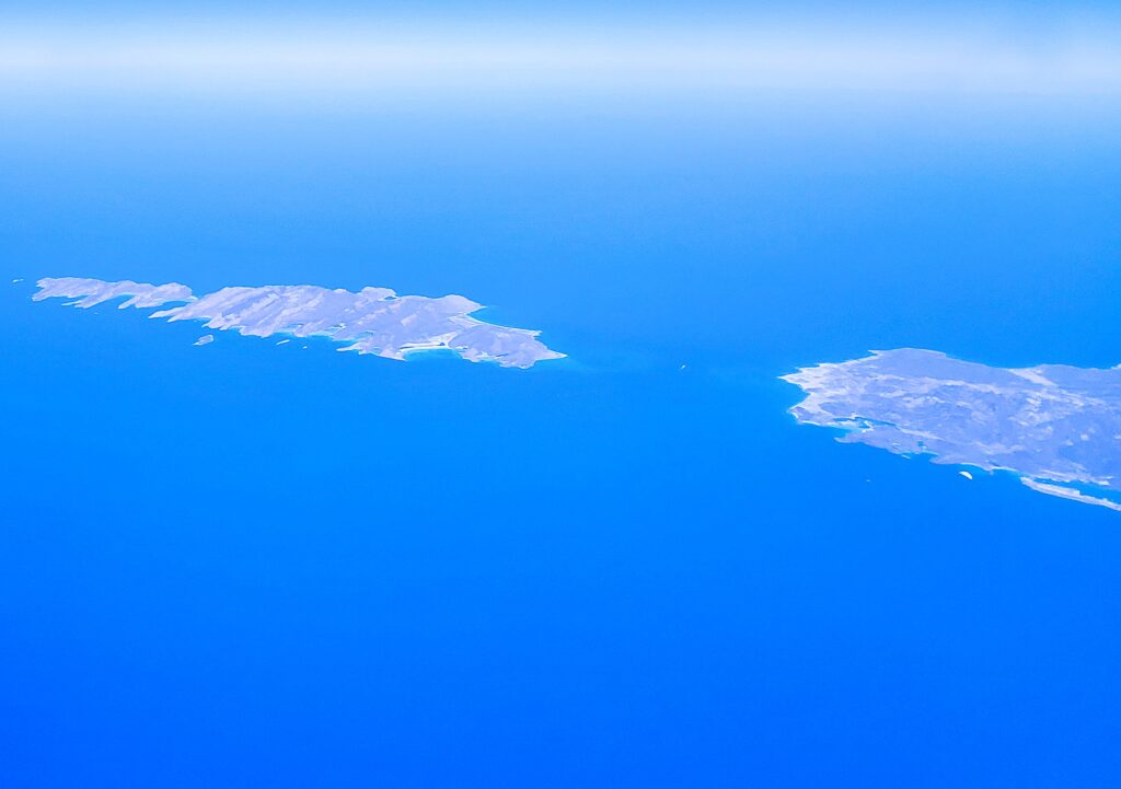
One of the most striking sights from the air is the jagged silhouette of Espiritu Santo Island. A UNESCO World Heritage site, this island is a labyrinth of red-rock cliffs and hidden turquoise coves that look unreal from 30,000 feet. Just south of the island, you can clearly see the shallow, swirling sands of Bandra Beach, often cited as the most beautiful beach in Mexico. These aerial images of Baja California Sur capture the raw, untouched spirit of the region—from the intricate patterns of the mangroves to the deep channels where whale sharks and sea lions migrate. For any traveler or photographer, seeing the La Paz coastline from above is the ultimate introduction to the “Aquarium of the World.”
Flying Over La Paz Mexico, BCS
You Might Also Like